Windows
Mac
Windows
Log in / Sign up
Windows
›
Tags › raster-based
Most popular
Raster-based
software
Relevance
Popularity
Rating
Arbortext IsoView
9,344
PTC
PTC Arbortext IsoView provides a web-based, interactive viewing environment that enables users to zoom, pan...
provides a web-
based
, interactive viewing...supports vector and
raster
illustrations, and static
Typograf
3,365
Neuber Software
This program lets you view all the fonts installed in your program, as well as to check their properties and compare...
This program lets you view all the fonts installed in your program, as well as to check
PDF-XChange Lite
free
3,349
Tracker Software Products Ltd
PDF-XChange Lite can help you create PDF documents from virtually any program...
to create your PDF
based
...name output files automatically
based
on specific patterns
ILWIS Academic
free
2,249
ITC
When looking for a powerful tool to satisfy various needs regarding...
needs regarding vectors,
raster
and satellite imagery...for managing vectors,
raster
and integrated GIS
Onis Free Edition
free
1,415
Digitalcore
Onis is a neat DICOM file viewer that comes with handy features such as the support for multi...
function or the MIP-
based
3D Volume rendering...export DICOM images to
raster
formats like JPEG
Photo Recover-Center
993
Recover-Center
Photo Recover-Center can recover photos regardless of the reason why these photos were lost. It can retrieve images...
formats, including popular
raster
ones like...Its wizard-
based
straightforward interface can
T2Laser
922
T2 Graphics LLC
T2Laser is a Benbox replacement for Grbl based laser engraving systems. It supports grey scale images, vector graphics...
Benbox replacement for Grbl
based
laser engraving...images or convert
raster
to vector
TatukGIS Viewer
free
610
TatukGIS sp. z o.o.
The TatukGIS Editor is a professional-level, desktop GIS mapping and data editing application designed...
The TatukGIS Editor is a professional-level, desktop GIS mapping and data editing application
Swift
527
Electric Rain, Inc.
A 3D software for graphic and rich media designers using Adobe Flash®...
A 3D software for graphic and rich media designers using Adobe Flash® and Microsoft Expression
Piranesi
461
Informatix Software International Ltd.
Although fully loaded with the tools needed to tackle the largest and most complex of projects, and based on new layering...
of projects, and
based
on new layering...price are two massive
raster
"Entourage" galleries
nanoCAD Plus
443
Nanosoft
nanoCAD Plus - easy-to-use low cost CAD software providing classic interface and native .dwg support...
developing independent nanoCAD Plus
based
applications
HPGL Viewer
free
428
IdeaMK
PGL viewer is free, small and compact viewer supported by all versions of Windows OS. This viewer allows you to open...
printer instruction file
based
on the plotter...expanded vector and
raster
information using
Flame Painter Pro
424
Escape Motions, s.r.o.
Flame Painter is a unique paint application that lets you easily create original...
Flame Painter is a unique paint application that lets you easily create original artworks, light
Academic Presenter
free
142
G.A.K Soft
Academic Presenter is a free presentation tool designed...
Academic Presenter is a free presentation tool designed by the academic community for the academic
OpenJUMP
free
96
Jump Pilot Project
OpenJUMP is an open source Geographic Information System (GIS)...
OpenJUMP is an open source Geographic Information System (GIS), it can read and write shapefiles
MainType
94
High-Logic
MainType is a powerful but easy to use font manager and font viewer, that takes the frustration out of managing...
Postscript Type 1, vector and
raster
fonts. You can preview...generate an HTML-
based
CR8tracer
free
64
Allan Murray
CR8tracer is a free utility for tracing bitmaps. This application...
postscript file. It accepts
raster
images or bitmap graphics
GeoTIFF Tools
free
62
Frank Warmerdam
GeoTIFF represents an effort by over 160 different remote sensing, GIS, cartographic, and surveying related companies...
establish a TIFF
based
interchange format for georeferenced
raster
imagery. GeoTIFF
ZoomTags
free
45
TanSharp
ZoomTags is a FREE Windows Desktop software. It is used for creating zoomable tag clouds. A tag-cloud is a map of frequently...
that keyword occurs.
Based
...the graphics in various
raster
formats: BMP, PNG
VintaSoft Barcode .NET SDK
42
VintaSoft Ltd.
Professional .NET barcode reader and barcode generator for developers. The SDK reads & writes 1D and 2D...
creates either a barcode
raster
image with specified...barcode print quality tests
based
on: ISO/IEC
1
2
3
Tags
Software
View
Viewer
Raster images
Manage
Photo
Tools
GIS
Font
Zoom
Featured stories
See all
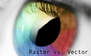
From Raster to Vector
What is a raster image? A raster image is made out of a certain number of pixels. It can also be called a bitmap or a digital image. A raster image...
EA brings a subscription-based program to PC
EA Origin Access brings you 15 games for $5/month.
Games based on TV series and movies
Ever wanted to control the fate of your favorite heroes from movies or TV series? These games will let you do just do that.
Logitech offers a hardware-driven way to make use of AI
One of the world's biggest hardware makers seeks to make AI closer to everyone with the help of a button.
Edge will probably let you limit its RAM usage
Despite its small market share, Microsoft continues to develop the Edge browser.